2.1.3 Kinematic GPS positioning
During a photo flight, the exposure stations may be estimated with the Global Positioning System (GPS). The coordinates determined with such a system primarily refer to the GPS antenna on the airplane roof (compare Section 5.3). BINGO offers the opportunity to connect the projection centres with the relevant antenna positions by a condition following to equation 2.1.2/1:

In BINGO the vector e' can be introduced as unknown, when a formulation is effected according to this equation. The weight of such an observation is fixed by entering an a priori standard deviation appropriate to the given accuracy.
It is often advantageous, if the conversion of the GPS antenna coordinates to the respective centre of projection is performed directly by the flight system because then the angle values of a stabilising platform can also be included in the calculation.
Pay special attention that the photo coordinate system for aerial photos has another position to the camera than the one for terrestrial photos (compare Section 2.1.1). Therefore a once defined vector e' is only to be used either for aerial or terrestrial photos.
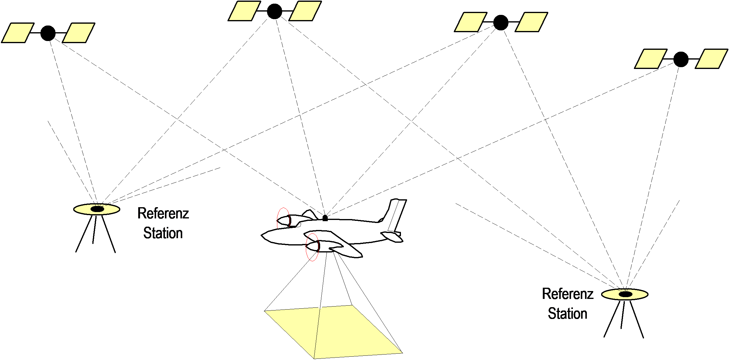
Fig. 2.1.3-1 Photo flight with GPS-recording
The critical element of this formulation is the possible systematic falsification of the GPS-coordinates during processing the GPS-data. For this reason a considerable improvement of the mathematic formulation is required.
During a photo flight, first the signals of the GPS-satellites (sine waves) are received continuously and recorded in a second or half-second bar or higher. This corresponds to a permanent distance measurement to every single satellite. However, the number of full wave lengths to the satellite is not known precisely (phase ambiguity). As long as the satellites are locked to the receiver, the variations of distances can be determined very precisely. By an observation duration of at least 15 minutes and a simultaneous data recording of at least one reference station with known coordinates, the flight track can be determined with high accuracy. As the airplane and the satellites are moving permanently, the solution of this task is mathematically difficult.
Losing lock to a single satellite and variations of the satellite configuration make the task more difficult. For this reason the correct solution of all phase ambiguities can often only be reached with a high effort or may even be impossible.
However, wrong solutions of the number of full wave lengths partly falsify the calculated GPS-coordinates considerably. The influence on the geometric distortion depends on the satellite configuration and on the flight track. An exact description of the deformation of the flight track is not possible in an easy way. In any case the alterations are not linear. Despite of these problems the deformations will be alternatively corrected by the traditional shift and drift parameters.
The in earlier BINGO versions implemented rigorous CPAS method (Combined Phase Ambiguity Solution) is not available anymore.