10.2.1 Divergence of equation system
The most unpleasant error is divergence of the equation system, which means that during the iterations the corrections to the unknowns, and the a posteriori standard deviations of unit weight s0 increase. Three causes of such a divergence are listed below:
- Some measurements are greatly in error (e.g. distances are wrong by 1 km). Detection of such an error may be made easier by setting the maximum number of iterations to -1 (in the GUI to Zero), in order to check compatibility between observations and approximations without adjustment (see Section 2.3.2.1).
- Either approximations of orientations of certain photos are greatly in error or the approximate coordinates for certain points are wrong. The necessary steps will be described below.
- Network geometry is poor, so that some unknowns are poorly defined (e.g. narrow-angle intersection). Defects in the equation system will usually appear after a few iterations. If the corrections to the unknowns are listed during each iteration, these ill-conditioned areas of the network become obvious. The poorly defined unknowns normally obtain the greatest corrections. A stable state can only be reached by adding further measurements or by using different observation weights. It will be pointed out principally: The poorer the geometry of a network, the higher the accuracy requirements for the approximations.
In case the initial approximations of the photo orientations have been estimated by RELAX, there are normally no problems with bad approximations. By principle considerations it will be shown in which cases insufficient initials can lead to divergence of the block, and what has to be done to correct those situations.
The example (Fig. 10.1.1-1) shows totally absurd intersection coordinates for the object point caused by wrong rotational angles. The point lies "behind" the camera.
During computation of the approximate coordinates of the object points from photo coordinates all existing rays for a point must intersect in all combinations. Then a weighted averaging is done where the respective weight is a function of the intersection angle of photo rays. Then the point coordinates of the various points are corrected by iterative adjustment. Grossly false approximate coordinates are then only possible for points which have been measured in only two photos and the approximate orientations of the photos are far too inaccurate. Then the wrong coordinates of the object points cause the divergence, and not the bad orientation data.
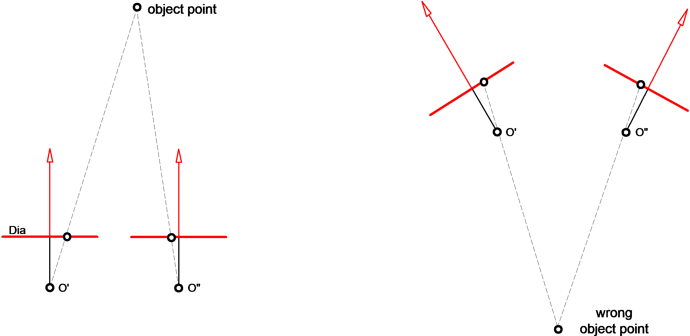
a) correct b) gross error
Fig. 10.1.1-1 Relative exposure angle
The photo orientations of all photos, particularly the angle κ, must then be carefully checked. If checking reveals no error, it is recommended either to digitise the approximate coordinates of object points (at least partly) from existing representations (e.g. planimetric representation), or to measure them manually to add them to the GEO INPUT file. Points thus defined facilitate the check of conformity between photo orientations and point coordinates if the maximum number of iterations is set to -1 (in the GUI to Zero) (see Section 2.3.2.1).
A further possibility for error detection in such a case would be division of the block.
If the overlap is large, it may be advisable at first to restrict the number of photos in use by means of an IMAG statement. The photos should then be selected to prevent unfavourable intersections and short bases. When convergence has been reached, and when the approximations of point unknowns and photo unknowns have been incorporated in the ITERA file, further photos may be added.