BINGO 5.4 - July 2007
This page describes BINGO as it existed at the stated release date. For current behavior and requirements, use the current Manual, Reference, and Guides.
BINGO 5.3 had been released in February 2006. Since April 2006 it has been available to all maintenance customers. During one year, only three very small corrections became necessary. Two of the problems have been reported from customers, one has been detected here in my office.
BINGO 5.4 is now ready for delivery. It comes with a lot of new features and new possibilities. It is running as well under Windows Vista 32 and 64 bit.
Overview
Two new tools are available from the manager’s menu: SAMBA and LIMBO.

Two more new tools have their own new buttons, and one button has enhanced functionality: A new GUI editor especially for the file geoin.dat, a button to view or edit any file, and a tool to easily recognize weak areas in the block.

This software version is furthermore prepared to handle JAS150 line scanner images. This functionality will become available to all maintenance customers, as soon as the first JAS150 cameras are delivered.
GPS/IMU data can now have separate a’priori precisions for X/Y and for Z.
Important files like geoin.dat, itera.dat, image.dat and skip.dat will be saved to old-…. before overwriting.
SAMBA: Reduction of tie points for automatic triangulation measurement
Automatic triangulation programs sometimes provide too many points per photo. Also the distribution of points might vary considerably in different areas of a block. Several points with different numbers can have identical photo coordinates. The new tool SAMBA finds and corrects these problems in a user-defined manner. The program will ignore fiducial marks and control point photo data.
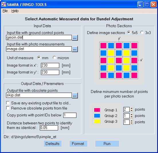
The search areas in the photos can be divided in 3 by 3 or 5 by 5 sections. The size of these areas is dependent upon the photo format. It is recommended to push the ″Format″ button before running the program. In case of 5 by 5 sections, the color code table allows for different sections to have varying numbers of points after thinning. In case of 3 by 3 sections, only one selection is available for all 9 areas.
The reduction of points is done in the following steps: First identical points are identified and removed, then one-ray points, then points with two rays, three, four, five … rays. This sequence guarantees that the points with the best connections will remain in the data set.
The program applies ALL photos from the image coordinate file and does not care about any point or photo selection in the project file!
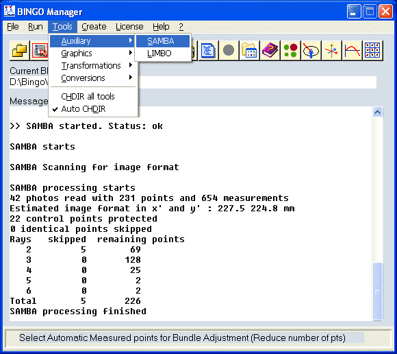
A report of removed and remaining points is given in the BINGO Manager’s window. SAMBA does not affect the image coordinate file directly. Thereforee it is possible to run SAMBA several times directly in sequence until you see a satisfactory result in the report.
Obsolete photo measurements are reported to the SKIP-file. Program SKIP can remove these measurements completely from the file or mark them with ″*″ (asterisks), depending on the check box ″Remove obsolete points from file″ in the GUI. After running SAMBA, the SKIP button HAS TO BE PUSHED to apply the latest SAMBA result to the image coordinate file.
After using this tool, identical points are removed and an even distribution of points is guaranteed. The computation time and the effort for error detection can be greatly reduced.
Example SKIP-File from SAMBA:
** <___Point><___Photo><LINE><__Rays><_Wi/Vi>
SAMBA
SKIP 8006496 * 0 4 (identical points)
SKIP 8008337 * 0 3
SKIP 8008328 * 0 3
: : : : :
SKIP 8000001 * 0 1 (one-ray points)
SKIP 8000119 * 0 1
SKIP 8000209 * 0 1
: : : : :
SKIP 6123911 * 0 2
SKIP 6131008 * 0 2
SKIP 6132703 * 0 2
: : : : :
: : : : :
SKIP 6133205 * 0 6
SKIP 6133211 * 0 6
SKIP 6133611 * 0 6
: : : : :
SKIP 6123909 * 0 7
SKIP 8002323 * 0 7
SKIP 9000138 * 0 7
LIMBO Listing Missing Bundle Observations
In most cases automatic triangulation programs do not measure the tie points in all possible images. Several photo measurements are missing. This new tool may be started after BINGO bundle adjustment. It creates a list of missing photo measurements with their related expected photo coordinates to allow automatic matching programs to identify and measure these missing points.
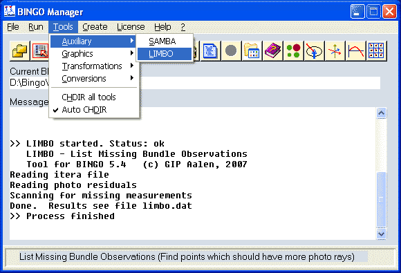
The program has no dialog or GUI. It reads the actual project file, selects the itera file [itera.dat] and the image residual file [imresi.dat] according to the project file and starts processing. The result is presented in file limbo.dat and contains as well all skipped measurements.
Example Limbo.lis-File from LIMBO:
-
BINGO Tool LIMBO: List Missing Bundle Observations
-
List of skipped photo measurements
*<Point_ID><Photo_ID><adjusted_x'_y'><__residuals_x'y'><Comments>
8016709 1315 54.8433 59.5434 344.2 -329.4 skipped
8026430 1313 -40.7869 77.9684 62.0 -141.7 skipped
8017963 1315 -10.4254 48.7576 -56.2 18.6 skipped
: : : : : : :
: : : : : : :
-
List of missing photo measurements
*<Point_ID><Photo_ID><_approximate_x'_y'>
8026972 1330 108.891 -35.841
8026538 1313 -49.655 85.529
8026538 1314 18.620 81.934
8026538 1315 85.968 81.096
8020904 1336 107.452 4.992
: : : :
: : : :
*----------------------------------------------------------
geoinEdi: New GUI to handle data in file geoin.dat
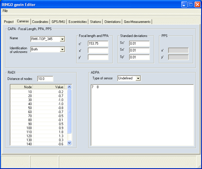
Several users have commented that they would prefer a GUI to edit the geoin.dat file rather than using a text editor. As a result I have developed a special GUI to handle this file. For handling details see file geoinGUI.pdf.
This editor GUI program will be started from the BINGO Manager. It opens the current geoin.dat file automatically. Other files of this type might be selected and opened by menu.

Data editing is mainly self-explanatory and should be done according to the detailed explanations in the BINGO manual.
Edit / View BINGO Data Files
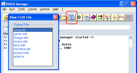
Using your preferred editor program, the new View / Edit button allows opening and viewing or editing any file in the current BINGO directory. Pushing the button, a list box with all available files will be displayed. A single click (double click for the first item) will open the file.
WAPLO Weak Area Detection and Plotting
A new graphics tool has been added for easier detection of problem areas in a block. It can display or plot an overview of the block regarding the precision.
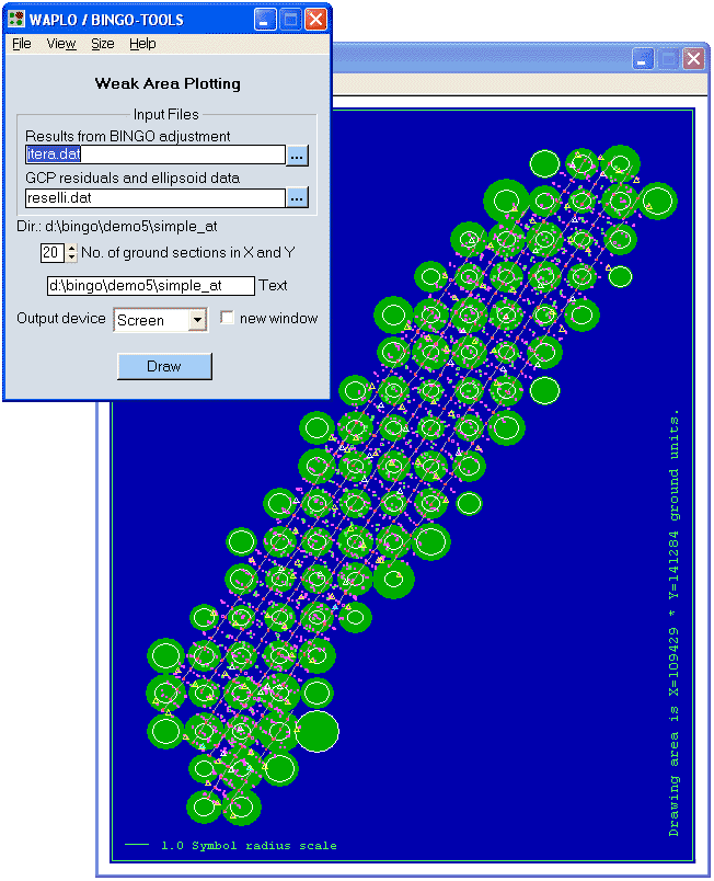
The program estimates per point the three major axes of the confidence ellipsoids. An RMS point precision will be estimated from all these major axes of the ellipsoids. The first axis is always the longest one. (For aerial blocks mainly in Z-direction.)
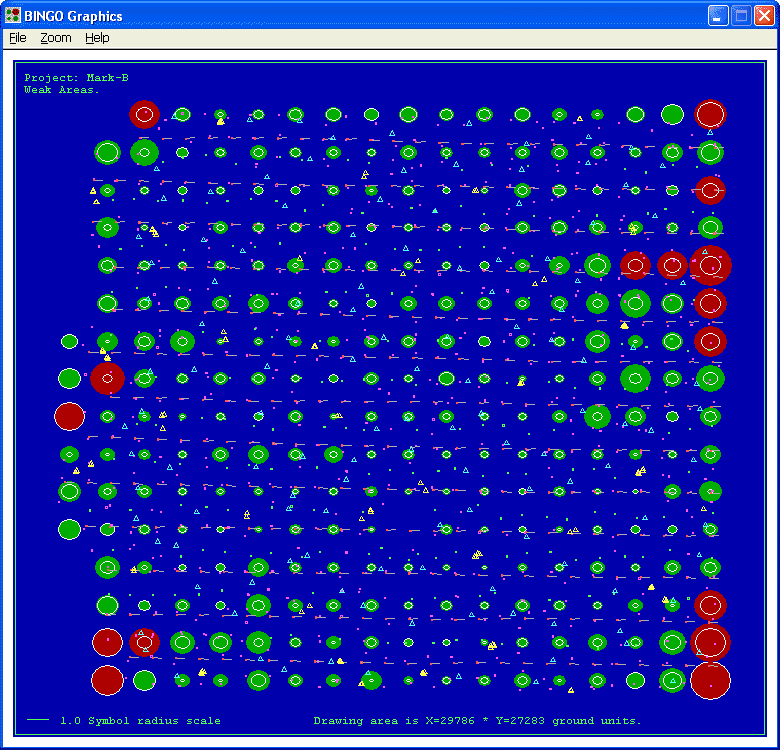
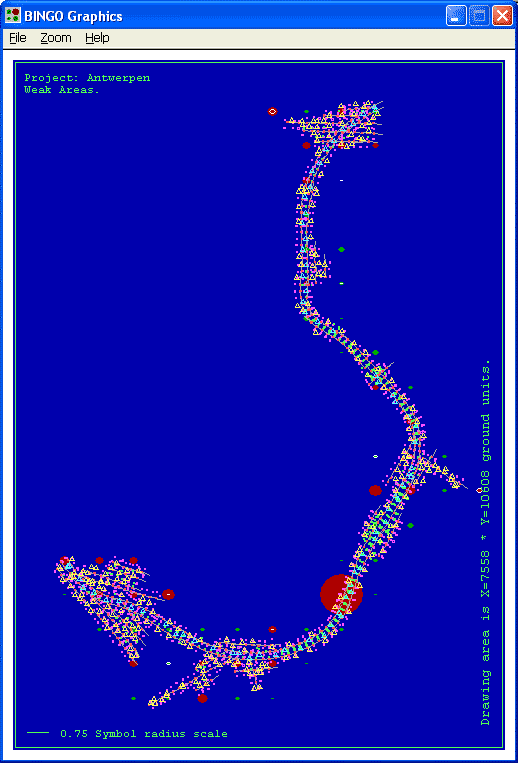
In a next step the block will be divided into a selectable number of zones [default 20]. For each zone the longest and the shortest first axis of the ellipsoids inside will be selected for graphical presentation as a circle. The longest axis per zone gives the radius for a filled circle, the shortest axis for a white circle inside the filled circle. The color of the circles changes from green to red for all areas, where the longest axis exceeds the RMS point precision by a factor of three.
This away any weak area can be identified easily for detailed evaluation by other tools. The first example above demonstrates a perfect result. The precision is very homogeneous over the whole area.
The next example indicates missing tie points in some areas and weak block corners.
The last example indicates some huge ellipsoids in one area. There might be points, measured only in two photos with an extremely short base length.
Saving files before overwriting
Existing files geoin.dat, image.dat, itera.dat and skip.dat will be automatically overwritten from BINGO programs. This new BINGO version creates a safety copy of these files before overwriting. The name of these saved files will be old-xxx.dat.
The prior backup (image.bck) of file image.dat changed the name to old-image.dat.
Weighting of GPS data
For DGPS data the weight for XY and Z can be defined separately in this new BINGO version. The GPS / IMU files remain unchanged. The different weights are defined in the FILE statements.
FILE GPS filename
receives now two (or none) instead of one factor for standard deviation, one for X/Y, and one for Z.
FILE IMU filename
receives now four (or none) instead of three factors for standard deviation, one for X/Y, one for Z, one for φ/ω and one for κ.
In the prior BINGO versions the given XYZ GPS standard deviation in the GPS/IMU files was used as the radius of a ball. Now it is used as a single standard deviation in the direction of the coordinate axis.
Example
GPS data file:
#event time X Y Z Sxyz
33 159250.007591 10600094.0424 4239688.1005 1401.4480 0.10
34 159282.853279 10598065.4247 4239615.4024 1400.6817
File geoin.dat:
GPS antenna coordinates
key file option Factor_XY Factor_Z
FILE GPS antenna.dat +e 0.5 0.7
This combination leads to the following GPS standard deviations:
Sx = 0.05, Sy = 0.05, Sz = 0.07
Line Scanner Images
Bundle adjustment for JAS150 line scanner images. The geometry of this airborne scanner is quite different from frame images or digital area sensor images. Along a flight trace 9 CCD lines are mapping the earth surface (push broom principle).
Identical points on the ground can be found in five panchromatic images along one flight trace. Thereforee, in combination with GPS-IMU data a bundle triangulation is possible to determine the complete flight trace and the ground coordinates.
Full sensor calibration and graphical presentation of all results is included.
This camera is similar to Leica’s ADS40. The full adjustment for ADS40 images with BINGO – planned since several years – will be developed during this year.