GeoInEdi
Edit BINGO GEO input files
Sprache
Diese Programmhilfe ist derzeit nur auf Englisch verfügbar.
GeoInEdi is launched from BINGO Manager. It automatically opens the GEO input file selected on the Project page of the BINGO parameter window. To edit another GEO input file, select File > Open.

Figure 1 — Starting GeoInEdi
Using GeoInEdi
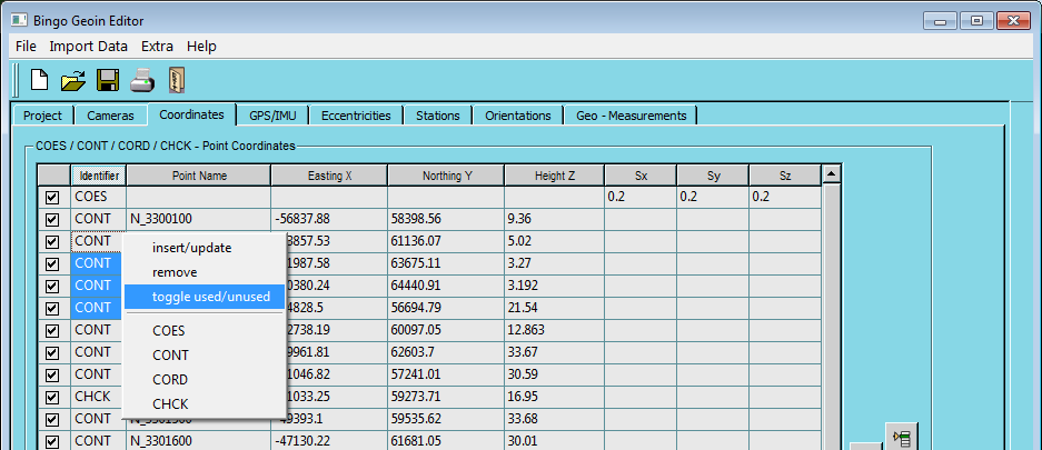
Figure 2 — Adding data lines
- To add data to a list, such as on the Coordinates page, right-click to open the context-sensitive menu, select an identifier such as
CONT, and enter the data in the fields. You can also add point coordinates by selecting Import Data > Import Point Coordinates. - Select one or more rows, then use the context-sensitive menu to change their identifier or toggle whether they are used.
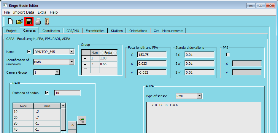
Figure 3 — Camera data
- An asterisk in column 1 of an
ADPAstatement marks that statement as inactive, as shown in Figure 3. - When using additional parameters for an aerial survey camera with a 230 mm × 230 mm image format, select Type of sensor = RMK.
- To convert a file in the BINGO 4.0 format used by some older photogrammetric workstations, enable Extra > Read Bingo4 Format, open the file with File > Open, and save it in the current format.
- Press
Ctrl+Sto save all data. PressCtrl+Xto exit GeoInEdi; if the data has changed, the program asks whether to save the changes, close without saving, or cancel.
For field definitions and valid values, see the GEO input file documentation.